UN
15 Alford Road
£ 375,000
Description
We don't have a Description for this property.
- Bedrooms
- 3
- Bathrooms
- 0
- Sqft
- 882.00
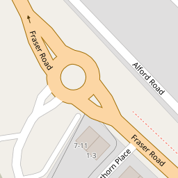

Leaflet © OpenStreetMap contributors
The heatmap indicates the level of crime in the area. The color of the heatmap indicates the crime severity and recency.
Metrics Year-on-Year
- Average area value
- 355,283.00 £Increased by 7.59 %
- Est sale value
- 418,950.00 £Decreased by 14.26 %
- Average area rental value
- 1,737.00 £/moIncreased by 15.72 %
- Est letting value
- 1,764.00 £/moUnchanged by 0.00 %
- Est rental Yield
- 5.87 %Increased by 7.71 %
- Crime Rate
- 13.00 %Unchanged by 0.00 %
from 330,234.00 £
from 488,628.00 £
from 1,501.00 £/mo
from 1,764.00 £/mo
from 5.45 %
from 13.00 %
Nearby Schools
| Name | Type | Ofsted | Distance |
|---|---|---|---|
| Trinity Church Of England School, Belvedere | Academy Converter | Good | 0.57 KM |
| St Fidelis Catholic Primary School | Voluntary Aided School | Good | 0.77 KM |
| West Street Children'S Centre | Children's Centre | 0.93 KM | |
| Christ Church (Erith) Cofe Primary School | Academy Sponsor Led | Outstanding | 1.00 KM |
| King Henry School | Academy Sponsor Led | 1.07 KM |
Images
Nearby Streets
| Name | Average Price | Average Sqft | Distance |
|---|---|---|---|
| Hillside | £ 0 | 0 | 0.00 KM |
| Tower Court | £ 0 | 0 | 0.00 KM |
| Valley Road | £ 560,000 | 0 | 0.00 KM |
| Randall Close | £ 365,000 | 0 | 0.00 KM |
| Carlton Road | £ 250,000 | 0 | 0.00 KM |
Nearby Transport
| Name | NLC | TLC | Distance |
|---|---|---|---|
| Erith | 5104 | ERH | 1.05 KM |
| Belvedere | 5092 | BVD | 1.76 KM |
| Barnehurst | 5089 | BNH | 2.21 KM |
| Slade Green | 5154 | SGR | 3.26 KM |
| Bexleyheath | 5094 | BXH | 4.21 KM |
Nearby Listings
| Address | Price | Type | Score | Distance |
|---|---|---|---|---|
| Hawthorn Place, Kent, DA8 | £ 195,000 | BUY | Unknown | 0.08 KM |
| Friday Road, Erith, DA8 | £ 350,000 | BUY | 7 / 10 | 0.10 KM |
| Friday Road, Erith, DA8 | £ 400,000 | BUY | 7 / 10 | 0.10 KM |
| Friday Road, Erith, Kent, DA8 | £ 325,000 | BUY | Unknown | 0.11 KM |
| Athol Road, Erith | £ 180,000 | BUY | 4 / 10 | 0.17 KM |
Nearby Properties
| Address | Price | Distance |
|---|---|---|
| 15 Alford Road | £ 375,000 | 0.00 KM |
| 16 Alford Road | £ 258,000 | 0.00 KM |
| 29 Alford Road | £ 177,000 | 0.00 KM |
| 28 Alford Road | £ 310,000 | 0.00 KM |
| 26 Alford Road | £ 357,000 | 0.01 KM |